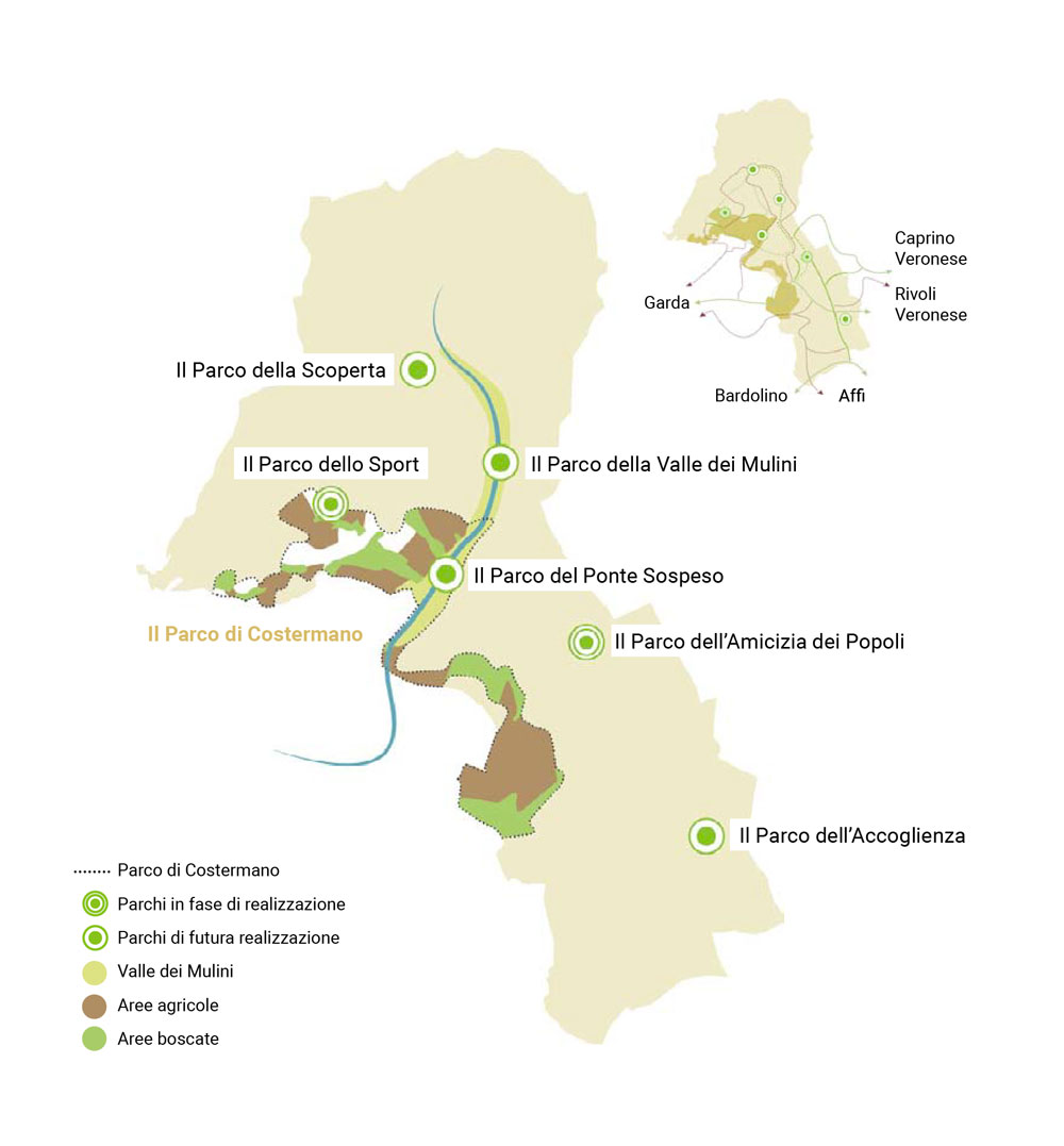
The “Parco di interesse Locale di Costermano sul Garda” covers an area of approximately 192 hectares and includes the western part of the municipal territory with the most important natural elements belonging to the municipal and provincial ecological network, as well as the Natura 2000 IT 321007 site “Monte Baldo: Val dei Mulini, Senge di Marciaga, Rocca di Garda”.
The heart of the park is the Valle dei Mulini. The Park extends west to the hamlet of Marciaga, north to the town of Campagnola and south-west to the town of Baesse. The Park has already been approved by the Municipal Council in 2017, by the Region of Veneto and the Province of Verona and overlaps the SIC (Site of Community Interest) identified by the Region in 2008.
The area within the boundaries of the Park was divided into homogeneous functional zones (i.e. functional zoning), in order to be able to upgrade the protection measures and use of the resources. This allows the territory to be used for different purposes compatible with the objectives of conservation and enhancement of the sites of particular natural and ecological interest.
The Park area is characterised by the presence of numerous urban restrictions and safeguards, the Environmental Plan shapes the urban choices according to the guidelines and limits of the PAT (Plan for Territorial Ordering).
The area within the Park area will benefit from urban redevelopment and reorganisation of buildings, together with new interventions for tourist-accommodation facilities and residential buildings, which are aimed at improving the functional possibilities of the park within consistent and accurately defined destinations of use. However, in order to protect the area and reduce land consumption, the Park will have the lowest buildability index, which will be equal to only 0.9% per square metre. The park includes natural or semi-natural areas that are important for the protection of the biodiversity, landscape, history and culture of the territory. This area will constitute the fundamental armour of tourism with a number of rural trails to promote visibility of the various sites, connecting the villages to be recovered for rural, educational and recreational tourism, and linked to the knowledge of local traditions.